|
"Passing the Rubicon."
Sold, Another Copy Available
Condition. The print is in Very Good condition. Three of the four corners have creases or small tears. The only major fault is a 2 1/2 in (6.5 cm) tear in the upper middle right margin. This tear extends approximately 1/2 inch into the image area (sky in the image). The tear has been professionally repaired and does not detract from the overall appearance of the print. The entire lithograph is very clean and free of foxing or toning. Colors are bight and sharp and the paper is bright and untoned. An very attractive item. Absent the tear, I would rate the print as Fine.
The Repaired Tear:
From the front
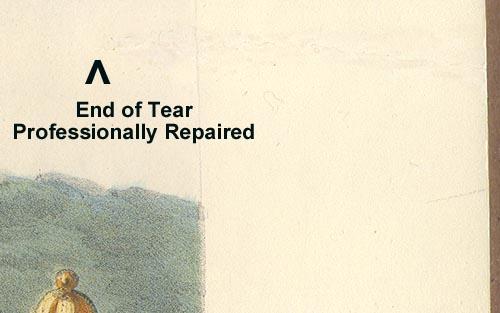
From the back

The Corners With Faults:
Upper Left
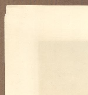
Upper Right
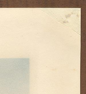
Lower Left
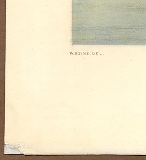
Brown, Eliphalet M. Jr. (Art and Publisher)
Heine, Wilhelm (Art):
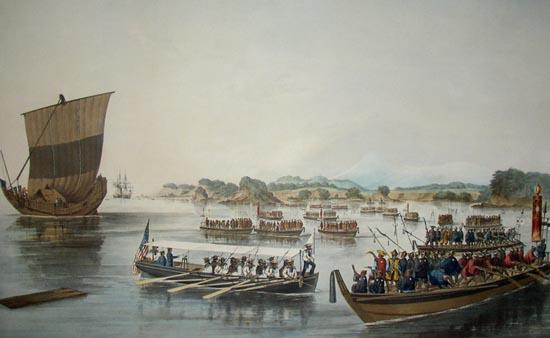
"Passing the Rubicon" from the folio titled Illustrations of the Japan Expedition, 1855. A lithograph from a folio of six (6) large ("Elephant" folio) high quality hand colored lithographic prints (36 1/2 x 26 in - 92.5 x 65.5 cm) produced and published by Brown in 1855 and printed by the lithographic printer of Sarony & Co, New York. The lithograph reproduces a drawing by Wilhelm Heine.
Titling (in order shown on print):

W. HEINE DEL -- E. BROWN Jr. DIREX -- SARONY AND CO LITH, N.Y.
PASSING THE RUBICON.
LIEUT. S. BENT IN THE "MISSISSIPPI'S" FIRST CUTTER FORCING HIS WAY THROUGH A FLEET OF JAPANESE BOATS WHILE SURVEYING THE BAY OF YEDO, JULY 11TH 1853
To Commodore M.C. Perry, Officers and men of the Japan Expedition this Print is respectfully dedicated by the Obt Servts, Heine and Brown, Jr.
Published by E. Brown, Jr. 142 Fulton St. New York.
Entered according to Act of Congress in the year 1855 by E. Brown in the Clerk's Office of the District Court of the Southern District of NY.
Lithograph Characteristics:
Type: Hand colored chromolithograph
Plate Size: 36 1/2 x 26 in -- 92.5 x 65.5 cm
Image Area: 23 1/2 x 20 1/2 in -- 82 x 52 cm
Printed on medium thick high quality card type stock
Key Images from the Print:
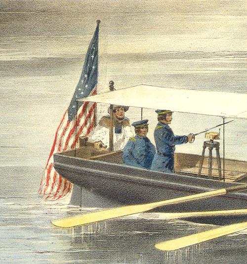
The American survey boat commanded by S. Bent
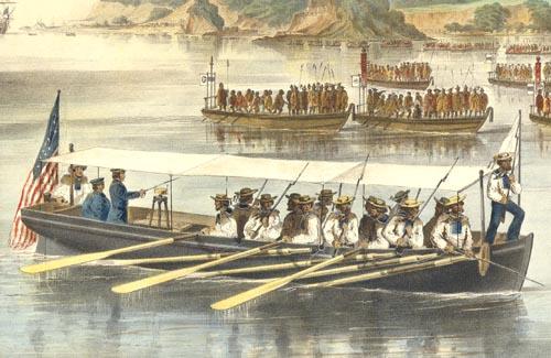
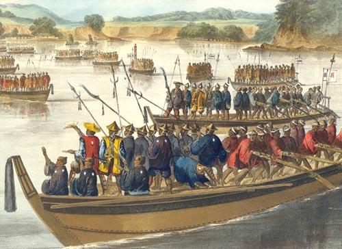
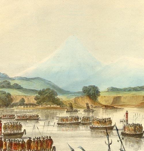
Japanese boats confronting the American boat
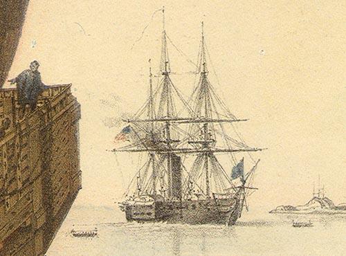
The Mississippi standing Watch over the survey boat
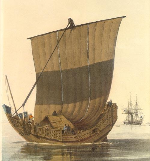
A large Japanese boat standing watch over the American survey boats
Mount Fuji in the background
A close-up showing lithographic texture
Context of Lithograph in the Perry Expedition to Japan.
Perry's squadron of four ships arrived in Yedo Bay on July 7, 1853 and anchored on the western side of the bay off the city of Uraga. On this first visit to Japan, Perry's primary mission was to deliver the President's letter to the Emperor of Japan. While negotiating the conditions under which the letter would be delivered, Commodore Perry dispatched boats to survey the harbor. This lithograph depicts the confrontation on July 11, 1853, between an American survey boat under the command of Silas Bent and Japanese boats. This scene probably represents the first direct potential for armed conflict with Japanese military forces experienced by the Expedition.
The narrative states:
A boat had been sent at daylight from each ship of the squadron to survey the bay and harbor of Uraga. The governor, on observing these boats, inquired what they were doing, and when he was told that they were surveying the harbor, he said it was against Japanese laws to allow of such examinations; to which he received for reply, that the American laws command them, and that Americans were as much bound to obey the American as he was the Japanese laws.
The surveying boats, which seemed to give so much uneasiness to the governor, had been well manned and armed, and Lieutenant Bent, of the Mississippi, who was in command, was instructed not to go beyond the range of the ship's guns, while a good look-out was kept upon the surveying party, in order that assistance might be sent to them should they be attacked. In addition to the usual boat ensigns at the stern, white flags, indicative of their peaceful intentions, were borne on the bows. They spread themselves out toward the opposite shore as they pulled away, sounding at every boat's length, and had reached about two miles further up the bay than the anchorage of the squadron, when they were recalled by a signal gun. On their return they were sent out again, with orders to keep nearer to the western shore. In the afternoon all the boats returned, coming alongside at about three o'clock pm.
On the first approach of the survey boats the soldiers showed themselves in considerable force, and were observed to be fully armed. They presented quite a bristling front with their spears and match-locks, while their lacquered caps and shields flashed brightly in the sun. They did not seem disposed, however, to make a very decided stand, for they retreated within the walls of the fortifications as soon as the boats made in closer with the land. One of the officers in command of a ship's boat approached to within a hundred yards of the shore, and observing three persons seemingly of authority, standing out upon an embankment, levelled his glass at them, whereat they disappeared on the instant, evidently much discomposed at being sighted with an instrument which they (though not unfamiliar with the telescope) might have supposed to be a weapon unknown to them, and capable of projecting something more deadly than the glance of an eye. The Japanese soldiers in the boats along shore beckoned to our officer to keep off, while he, in response made a sign to show the direction in which he was going. The Japanese then put off and approached so rapidly that it appeared as if their intention was to intercept the ship's boat, and the officer in command accordingly gave
orders to his men to rest upon their oars, and adjust the caps to their carbines. There was, however, no attempt directly to interfere with this or any other of the ship's cutters, although they were followed by numbers of Japanese boats, which, however, on seeing our men well armed, did not venture to molest them. The artist who accompanied the surveying party had an excellent opportunity, which was well improved, of making sketches of the land, the forts, and various other objects on shore.
Everything seemed propitious, as the action of the Commodore had so far been crowned with success. He had gained his purpose in clearing the squadron of the presence of guard boats; he had compelled the visit of the first in authority at Uraga; he had surveyed the harbor; he had refused to go to Nagasaki, and kept his position in the bay of Yedo; and this last he determined to retain until he had some definite answer to the reception of the President's letter by a person of proper rank and authority. (Narrative, p. 238-9)
The Title - "Passing the Rubicon." The term passing the rubicon is often used to signify the taking of an irrevocable step or the point of no return. It is very frequently applied to military actions and was derived from Julius Caesar's crossing the Rubicon in BC 49 to march against Pompey in defiance of the senate’s orders. By crossing the Rubicon (actually a small stream) Caesar committed himself to conquer or to perish. I believe this is the meaning the title to this print conveys. Commodore Perry, by sending his boats out to test the Japanese response, took an irrevocable step in his mission.
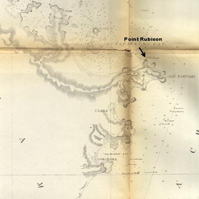
Point Rubicon. There was a geographical location in the area depicted in this print which was named Point Rubicon. I presume this was named so by Commodore Perry as were many of the points on maps being complied by the expedition. Point Rubicon is located north of Uraga. It is shown on Map 11 in Volume 2 of the Narrative of the Expedition. The map is titled Gulf and Bay of Yedo. Below is the portion of the map showing Point Rubicon.
"Gulf and Bay of Yedo"
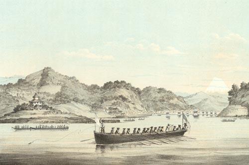
Related Lithograph in Official Narrative. A similar scene to "Passing the Rubicon" is found in Volume 1 of the U.S. Government published Narrative of the Japan Expedition. It is found at page 233 and titled "View of Uraga, Yedo Bay." The lithograph is based upon Wilhelm Heine's drawings. It features an American surveying boat with a white flag. At the bow of the boat a sailor is tossing a sounding instrument. Near the stern of the boat, another sailor is observing through a telescope. Japanese boats and ships are in the adjacent waters. In the right background you see Mount Fuji.
"View of Uraga, Yedo Bay" by Wilhelm Heine
This lithograph may be available for purchase.
To go to the lithograph price list, click here.
For price lists of various art work related to the Expedition, click here.
|


